Review of Bungendore Floodplain Risk Management Study and Plan
- Project value$207,000
- Contractor nameWorley Consulting
This project involves a review of the Bungendore Floodplain Risk Management Study and Plan (FRMS&P) completed in 2014. An update of the Bungendore FRMS&P is required to include land identified in the recently adopted Bungendore Structure Plan which is being investigated for future urban uses beyond the current town boundary. The Bungendore FRMS&P will also be updated to comply with recently revised national guidelines for flood estimation.
The study area for the project encompasses the entire village of Bungendore and the surrounding floodplains of Turallo, Halfway and Mill Post Creeks.
Funding has been obtained from NSW Department of Planning, Industry and Environment (DPIE) as part of the 2019/20 NSW Floodplain Management Program, with Council to provide 2/3 of the project funds to a maximum value of $138,000.
Worley Consulting have been engaged to produce the updated Bungendore FRMS&P.
Community Consultation
The initial consultation for this study encompassed a newsletter and questionnaire. As the study progresses, preliminary results will be placed on exhibition in the form of a draft report. The community will be invited to view and provide comment on this document.
In addition, public forums were held to present and discuss the results of the study.
What's been completed
- Data collection and review
- Stage 1 community consultation
- Update of flood models to ARR2019
- Flood model calibration and validation based on August 2022 flood event
- Meeting of Floodplain Risk Management Committee
- Draft Flood Study completed
What's next
Delays have been experienced on the project, particularly during the model development and calibration/validation stage. The primary reason for this was to incorporate the August 2022 flood event in the updated flood models, which meant revisiting the model updates after they had been completed.
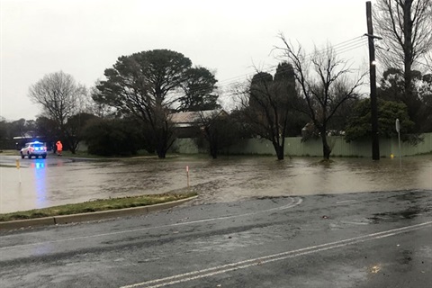
During the August 2022 flood event, a considerable amount of data was able to be gathered by Council, NSW SES and the local community. Previous flood events in Bungendore have limited rainfall and flood level information, making data from the 2022 floods valuable for model development and calibration/validation.
The next stages are:
- Floodplain management options to be developed
- Draft Floodplain Risk Management Study and Plan report produced (stage 2 consultation)
- Public Exhibition of Draft Floodplain Risk Management Study and Plan
- Finalise Floodplain Risk Management Study and Plan